Research Projects
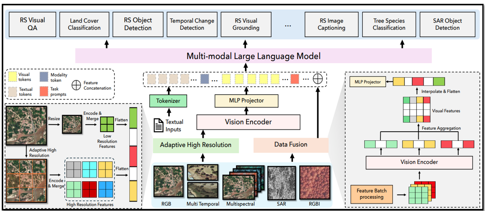
EarthDial
EarthDial transforms multi-sensory Earth observations into interactive dialogues, enabling natural language interactions with satellite imagery and remote sensing data. The system allows users to query, analyze, and understand complex geospatial information through conversational interfaces.
[CVPR 2025] Soni, Sagar, et al. "Earthdial: Turning multi-sensory earth observations to interactive dialogues." Proceedings of the IEEE/CVF Conference on Computer Vision and Pattern Recognition (CVPR). 2025.
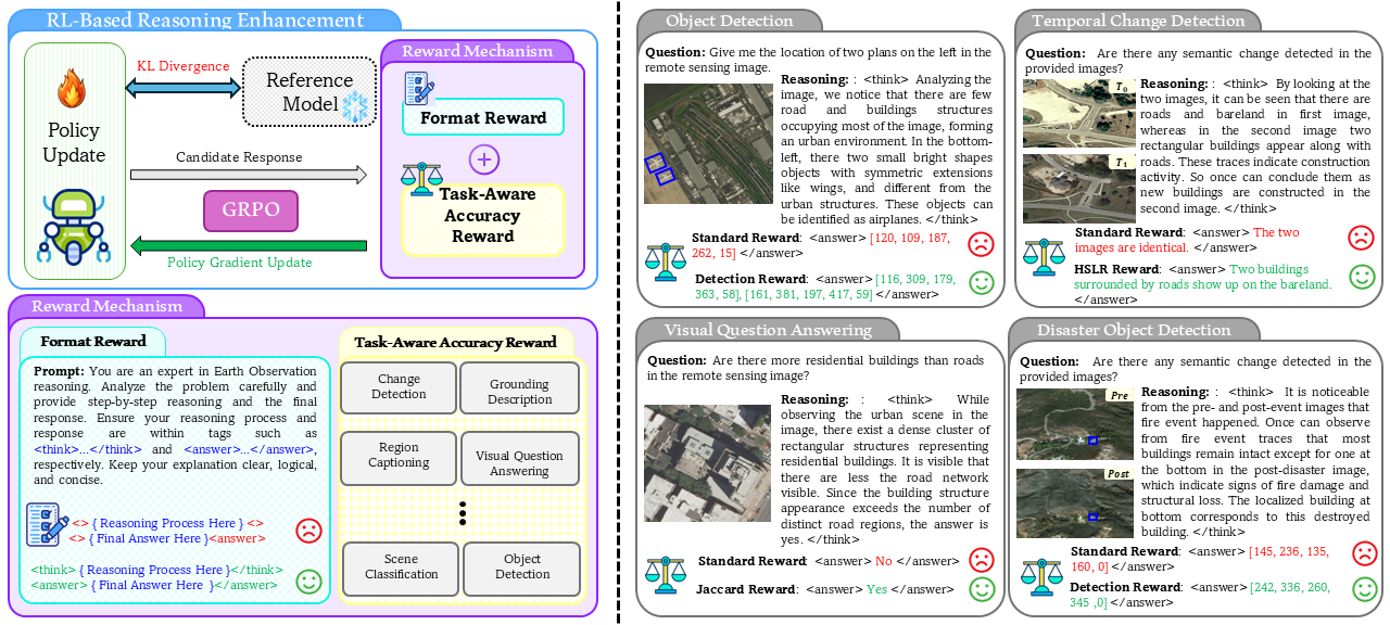
GeoVLM-R1
GeoVLM-R1 is a reinforcement learning framework that enhances vision-language models' reasoning capabilities for Earth observation tasks. The system is designed with flexibility, scalability, and ease of experimentation in mind, enabling advanced reasoning in diverse remote sensing scenarios.
[arXiv 2025] Fiaz, Mustansar, et al. "Geovlm-r1: Reinforcement fine-tuning for improved remote sensing reasoning." arXiv preprint arXiv:2509.25026 (2025).